
.
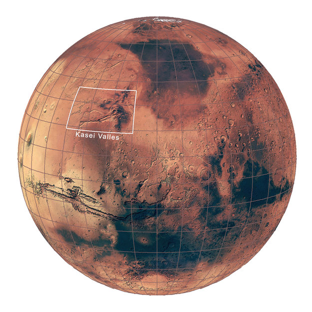
Kasei Valles
.
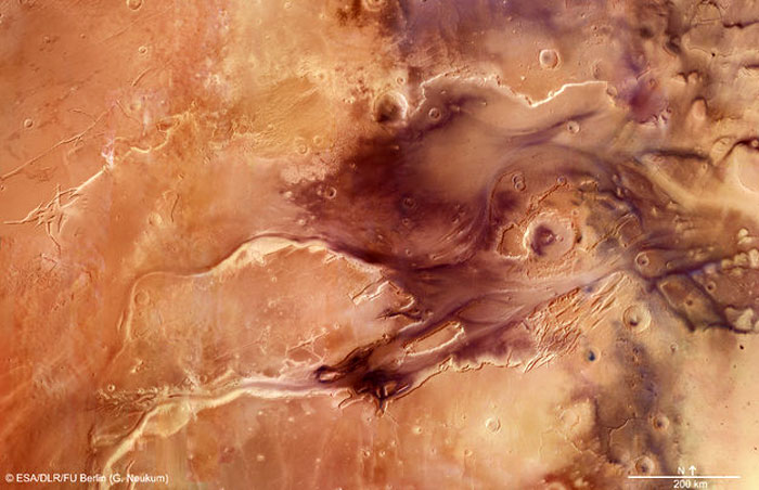
Dramatic flood events carved this impressive channel system on Mars covering 1.55 million square kilometres, shown here in a stunning new mosaic from ESA’s Mars Express.
The mosaic, which features the spectacular Kasei Valles, comprises 67 images taken with the spacecraft’s high-resolution stereo camera and is released during the week of the 10th anniversary of the spacecraft’s launch to the Red Planet.
Kasei Valles is one of the largest outflow channel systems on Mars – from source to sink, it extends some 3000 km and descends by 3 km in altitude. The scene covered in the mosaic spans 987 km north–south (19–36°N) and 1550 km east–west (280–310°E).
The channel originates beyond the southern edge of this image near Valles Marineris, and empties into the vast plains of Chryse Planitia to the east.
.
.
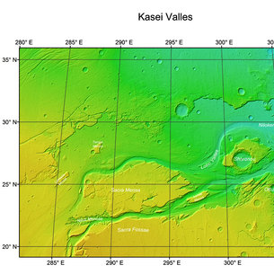
Kasei Valles topography
.
Kasei Valles splits into two main branches that hug a broad island of fractured terrain – Sacra Mensa – rising 2 km above the channels that swerve around it. While weaker materials succumbed to the erosive power of the fast-flowing water, this hardier outcrop has stood the test of time.
Slightly further downstream, the flood waters did their best to erase the 100 km-wide Sharonov crater, crumpling its southern rim. Around Sharonov, many small streamlined islands form teardrop shapes rising from the riverbed, carved as water swept around these natural obstacles.
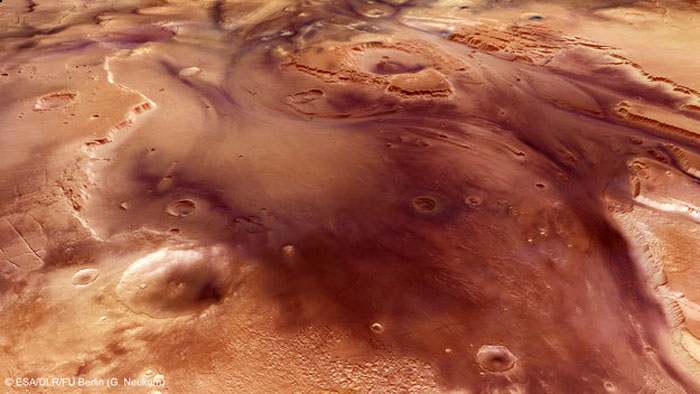
The region between Sacra Mensa and Sharonov is seen in close-up detail in the perspective view below, looking downstream from the northern flank of Kasai Valles.
Zooming into the valley floor reveals small craters with bright dust ‘tails’ seemingly flowing in the opposite direction to the movement of water. In fact, these craters were formed by impacts that took place after the catastrophic flooding, their delicate tails created by winds blowing in a westwards direction ‘up’ valley.
Their raised rims influence wind flow over the crater such that the dust immediately ‘behind’ the crater remains undisturbed in comparison to the surrounding, exposed, plains.
.
Perspective view of Kasei Valles
.
Kasei Valles has likely seen floods of many different sizes, brought about by the changing tectonic and volcanic activity in the nearby Tharsis region over 3 billion years ago.
The landscape was pulled apart under the strain of these forces, groundwater bursting from its ripped seams to create not only violent floods, but also the unique fracture patterns seen at Sacra Mensa and Sacra Fossae.
Snow and ice melted by volcanic eruptions also likely contributed to torrential, muddy outpourings, while glacial activity may have further shaped the channel system.
Now silent, one can only imagine from examples on Earth the roar of gushing water that once cascaded through Kasei Valles, undermining cliff faces and engulfing craters, and eventually flooding onto the plains of Chryse Planitia.
Quelle: ESA
6205 Views