
4.08.2026
Pre-operational data from Europe’s first meteorological infrared sounder in geostationary orbit are now available to users
Weather forecasters around Europe and beyond began receiving pre-operational data from Europe’s first infrared sounder operating from geostationary orbit. The data from the Infrared Sounder (IRS) will revolutionise weather forecasting in Europe.
Launched on 1 July 2025, MTG-S1 completed its satellite commissioning phase and move to its operational position at 0° longitude on 2 July 2026, when it was handed over to EUMETSAT. EUMETSAT completed in parallel a main aspect of the commissioning of the entire end-to-end system, covering the IRS instrument, the receiving antennas and the ground segment. This enabled the release of pre-operational IRS data to all users on 30 July.
Once fully operational, the IRS is expected to provide EUMETSAT Member States with new streams of atmospheric data, enabling earlier, more accurate warnings that protect lives, property and infrastructure. By scanning around 2,000 thermal infrared wavelengths every 30 minutes, the instrument will generate high-resolution vertical profiles of the atmosphere, providing a new level of detail for weather forecasting across Europe and surrounding regions.
Combined with cloud information and atmospheric instability indices, these observations will allow meteorologists to detect atmospheric instability before severe weather events develop and improve forecasts of rapidly evolving events such as heavy rainfall, tropical cyclones and winter storms.
The data are currently being disseminated on a pre-operational basis. Their quality is already close to operational standards, while EUMETSAT continues to fine-tune the system and address the remaining technical limitations. This phase is an important step towards full operations, when EUMETSAT will ensure the reliable and efficient delivery of the data to all users.
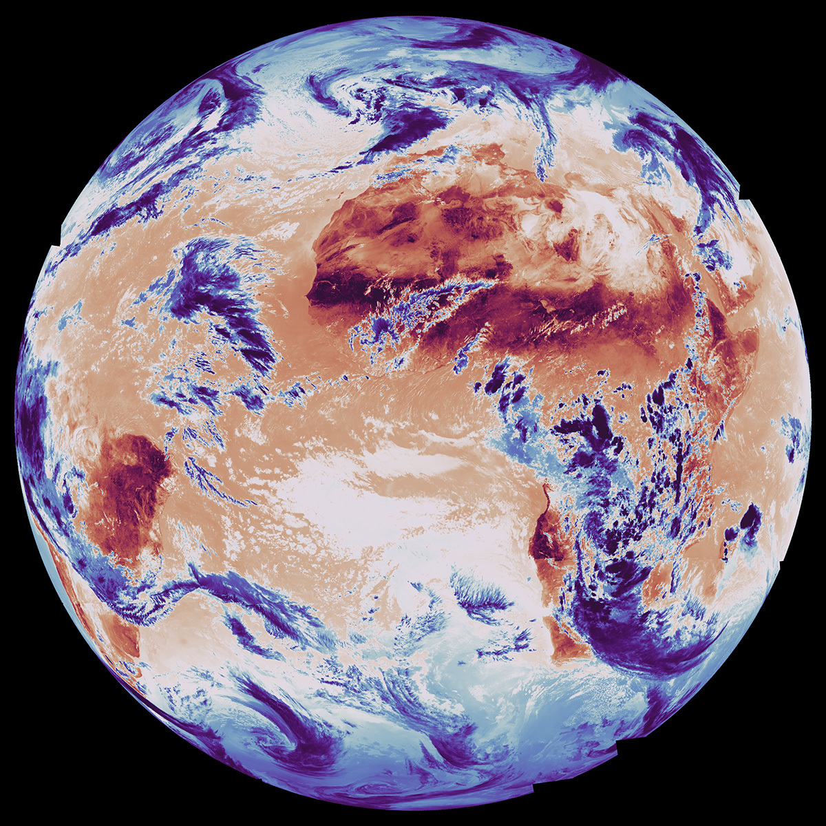
The first Infrared Sounder image viewed through this long-wave infrared channel (around 8.3 micrometres, one of nearly 2,000 channels measured simultaneously) shows clouds associated with Storm Claudia over western and southern Europe, which brought widespread disruption, heavy rain and flooding. Light at this wavelength passes largely unabsorbed through the atmosphere, revealing temperatures of cloud tops, land, and ocean surfaces. Deep blues mark the coldest features: polar ice and the tops of cumulonimbus clouds, which can be seen clearly over parts of Europe and sub-Saharan Africa where widespread convective activity associated with the Intertropical Convergence Zone spans from the Atlantic to Madagascar. Warmer yellows indicate ocean waters and whites indicate thin clouds such as low-level stratus and cumulus, while the surface of the Saharan desert swings between dark red when heated and cooler tones after nightfall.
Quelle: EUMETSAT