

The 701 club: Case 7134 November 29, 1960 South of Kyushu, Japan
Don Berlinner’s list describes the case as follows:
Nov. 29, 1960; south of Kyushu, Japan. 6:38 p.m. Witnesses: USAF Lt. Col. R.L. Blwlin (sp?) and Maj. F.B. Brown, flying a T-33 jet trainer. One white light 8lowed and paralleled the course of the T-33 for 10 minutes.1
Brad Sparks has no additional information. 2
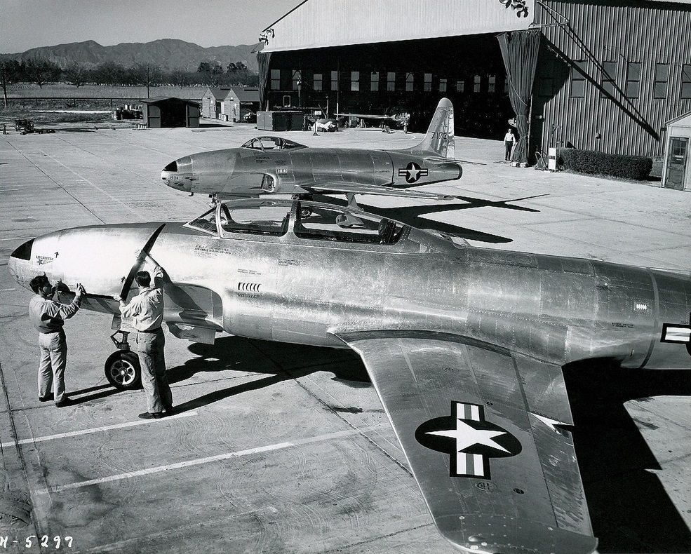
USAF T-33
The Blue Book file
The file contains the standard teletype report and a memo stating that space track checked and could not identify any spacecraft that could produce the report. Details regarding the sighting were mentioned in the teletype:
The shape was just a point of light similar to the north star. Its brightness was between 2nd and 4th magnitude
The light had a track that paralleled the aircraft. It went from azimuth 350 degrees to 30 degrees. It had an elevation of 45 degrees. At 30 degrees azimuth it disappeared suddenly.
The duration of the sighting was 10 minutes
The aircraft was at 21,000 feet with a heading of 15 degrees and True Air Speed (TAS) of 320 knots.
The time of the sighting was 0938 - 0948Z (1838-1848 local time).
No other aircraft were reported in the area.
A similar report was submitted on 25 October 1960.
Analysis
With such a report, I begin to think it was one of two possible sources. The first was it was an aircraft. The lack of any aircraft in the region and the sudden disappearance tends to rule that explanation out. The 25 October sighting mentioned in the report was probably a reference to the sighting from Okinawa on that date. It had been classified as an aircraft.
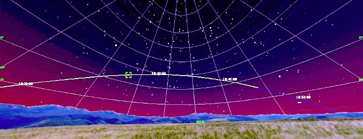
The second source was a satellite. However, Space track said there was no satellite in the region. To verify, I ran my Heavensat program with my late 1960 Two-Line Elements. I was shocked to see that the Echo satellite was making a pass in the region at the time of the sighting. I then ran the computations with a TLE dated for 29 November and got this result:
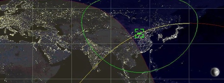
When I entered the approximate location described (the position was in relation to nearby islands) and put it into the sky mode, the track was pretty close to what was described. At 1838 local (0938Z), the azimuth was about 300 degrees and elevation was 20 degrees. At 1848 (0948Z), the azimuth was about 35 degrees and elevation was approximately 15 degrees. The peak elevation was 30 degrees. While the elevation was not exactly 45 degrees and the initial azimuth was more to the west, one has to remember the location given was not precise and I estimated the aircraft’s location. Additionally, the crew of the aircraft were making estimated locations in the sky and were not making precise measurements. It is most interesting that at the time of 1848, the satellite went into shadow resulting in it “disappearing suddenly” just as described by the crew.
Conclusion
It appears that space track did not have the correct information available. They may have had the wrong time, location, or date. They also may not have had the correct TLEs for the Echo Satellite. In any case, the Echo satellite is the source for this sighting and it should be removed from the list of Blue Book unknowns.
Quelle: SUNlite 6/2022