
18.08.2021
NASA Unveils New Interactive Website Ahead of Landsat 9 Launch
Editor’s Note: On Aug. 16, 2021, the builder of Landsat 9 was added.
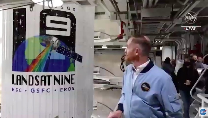
Landsat 9, a joint NASA and U.S. Geological Survey satellite mission, is scheduled to launch Thursday, Sept. 16, from Vandenberg Space Force Base in California. To help the media and public learn more about the project and its near 50-year history, NASA has launched a new interactive website:
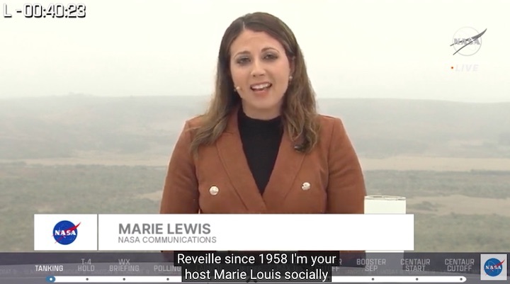
Members of the media are also invited to a remote media briefing Tuesday, Aug. 31, tentatively scheduled for 10 a.m. EDT. The briefing will allow reporters to address questions to scientists, mission managers, and data use experts. To RSVP for the briefing, contact Tylar Greene at: tylar.j.greene@nasa.gov.
The Landsat Program missions changed the field of Earth science when the Landsat 1 satellite launched in 1972. In 2008, the program created new opportunities for research around the world when it made decades of Landsat data available to the public for free.
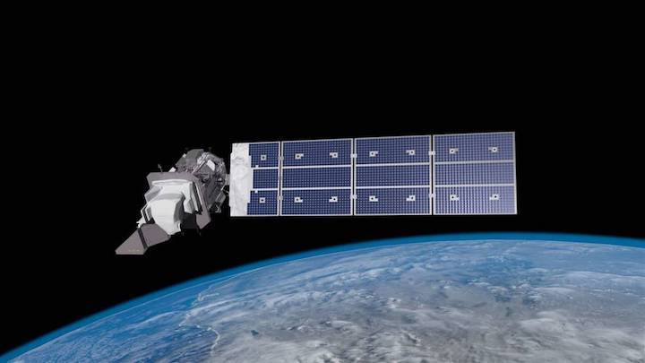
The Landsat 9 satellite continues the program's critical role in monitoring, understanding, and managing land resources – agricultural crops, water, and forests – needed to sustain human life.
Landsat’s data of Earth’s surface as seen from space have transformed scientists’ understanding of regional, national, and global-scale changes in land use and land cover, providing information for sectors including agriculture, forestry, urbanization, hydrology, and homeland security and disaster mitigation. Landsat 9 will continue this record of monitoring key natural and economic resources, as well as global environmental changes into the future.
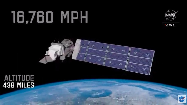
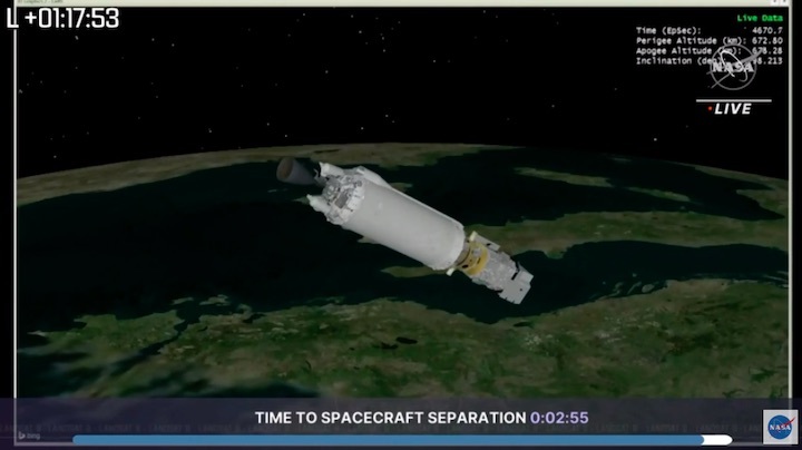
Once fully commissioned in orbit after launch, Landsat 9 will replace Landsat 7 and join its sister satellite, Landsat 8. Together, they will collect images that capture Earth’s land surfaces every eight days.
Landsat 9 uses similar instrument technology to Landsat 8. Carrying two sensors, the Operational Land Imager-2 (OLI-2), built by Ball Aerospace & Technologies Corporation, and the Thermal Infrared Sensor-2 (TIRS-2), built at NASA’s Goddard Space Flight Center in Greenbelt, Maryland, it will detect the reflected light and heat emitted from Earth’s surface across the visible, near infrared, shortwave infrared, and thermal infrared wavelengths.
The instruments will capture more than 700 new images daily across 11 wavelengths at 30-meter resolution. This resolution is fine enough to detect even small agricultural fields, buildings, forest stands, and lakes, while still providing a broad enough swath to cover large areas of terrain. With its 11 wavelengths, the instruments will capture information about Earth, including data related to coastal waters, forests, healthy and unhealthy plants, and wildfire scars in the visible light to thermal infrared ranges.
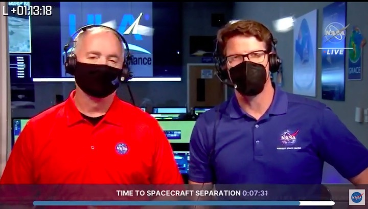
United Launch Alliance is the spacecraft provider for Landsat 9’s launch. Northrop Grumman built the Landsat 9 spacecraft, integrated it with instruments, and tested the observatory.
To date, more than 18,000 peer-reviewed research papers have used Landsat data, and many public and private programs use it to support agriculture, forest management, urban development, wildfire-damaged vegetation recovery, and many more applications.
Quelle: NASA
----
Update: 29.08.2021
.
Media Invited to Virtual Briefing on Launch of NASA, USGS Landsat 9
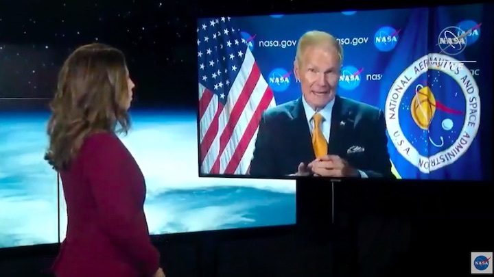
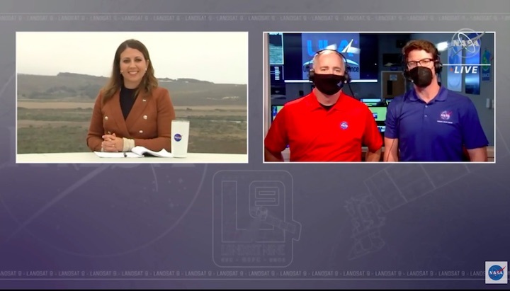
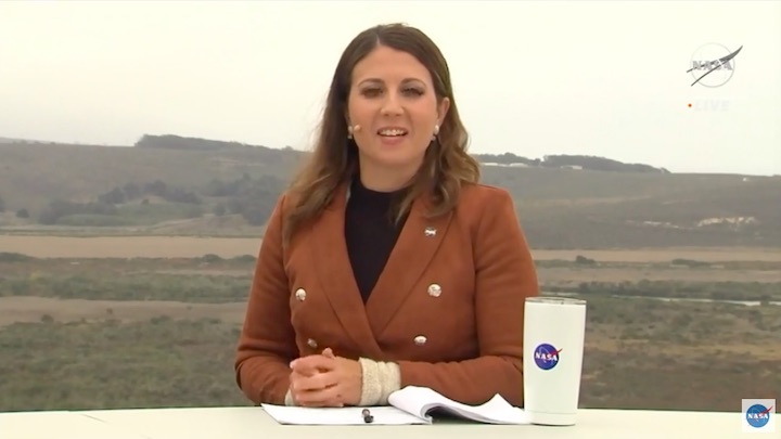
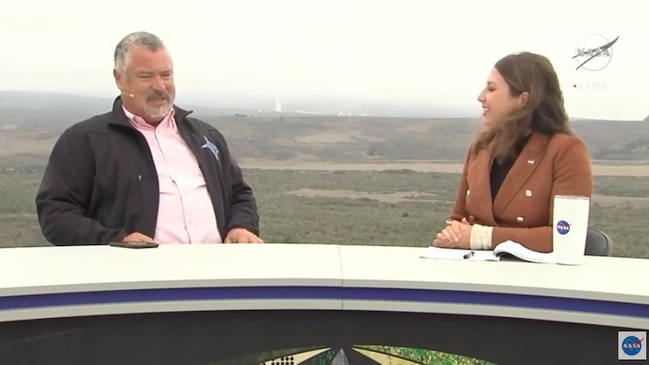
Officials from NASA and the U.S. Geological Survey (USGS) will discuss next month’s planned launch of the Landsat 9 satellite during a media briefing at 10 a.m. EDT Tuesday, Aug. 31.
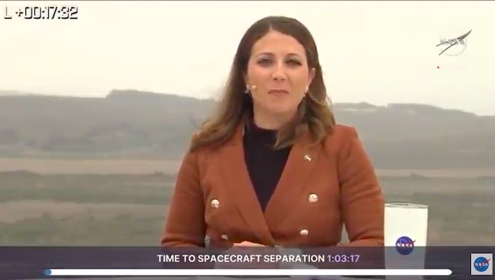
The Landsat 9 launch is targeted for no earlier than Thursday, Sept. 23, 2021.The media briefing will air live on NASA TV, the NASA app, and the agency’s website.
Data from Landsat 9 will add to nearly 50 years of free and publicly available data from the Landsat program. The Landsat program is the longest-running enterprise for acquisition of satellite imagery of Earth. It is a joint NASA/USGS program. Researchers harmonize Landsat data to detect the footprint of human activities and measure the effects of climate change on land over decades.
Once fully operational in orbit, Landsat 9 will replace Landsat 7 and join its sister satellite, Landsat 8, in continuing to collect data from across the planet every eight days. This calibrated data will continue the Landsat program’s critical role in monitoring land use and helping decision-makers manage essential resources including crops, water resources, and forests.
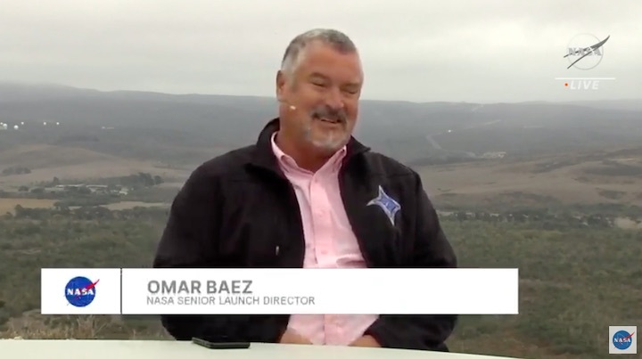
Briefing participants, in speaking order, are:
- Karen St. Germain, director of NASA's Earth Science Division
- Del Jenstrom, Landsat 9 project manager at NASA’s Goddard Space Flight Center in Greenbelt, Maryland
- Jeff Masek, Landsat 9 project scientist at Goddard
- David Applegate, acting director of USGS
- Birgit Peterson, geographer at USGS
- Inbal Becker-Reshef, director of NASA’s Harvest food security and agriculture program.
Media can RSVP and submit questions before and during the briefing by emailing Jacob Richmond at: Jacob.a.richmond@nasa.gov.
NASA manages the Landsat 9 mission. Goddard teams also built and tested one of the two instruments on Landsat 9, the Thermal Infrared Sensor 2 (TIRS-2) instrument. TIRS-2 will use thermal imaging to make measurements that are used to calculate soil moisture and detect the health of plants.
The USGS Earth Resources Observation and Science Center in Sioux Falls, South Dakota, will operate the mission and manage the ground system, including maintaining the Landsat archive. Ball Aerospace in Boulder, Colorado, built and tested the Operational Land Imager 2 (OLI-2) instrument, another imaging sensor that provides data in the visible, near infrared, and shortwave infrared portions of the spectrum. United Launch Alliance is the rocket provider for Landsat 9’s launch. Northrop Grumman in Gilbert, Arizona, built the Landsat 9 spacecraft, integrated it with instruments, and tested the observatory.
Quelle: NASA
----
Update: 17.09.2021
.
NASA and United Launch Alliance Update Landsat 9 Target Launch Date
![]()
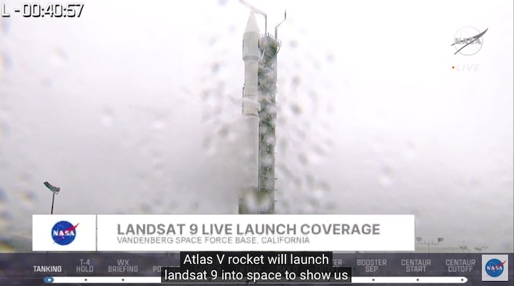
NASA and United Launch Alliance currently are reviewing the launch date for the Landsat 9 spacecraft scheduled to launch from Vandenberg Space Force Base in California. Attaching the spacecraft to the Atlas V rocket has been delayed due to out-of-tolerance high winds for the operation and conflicts with other customers using the Western Range.
The Landsat 9 mission now is expected to launch from Vandenberg’s Space Launch Complex 3 no earlier than Monday, Sept. 27, 2021.
Landsat 9 is a joint NASA and U.S. Geological Survey (USGS) mission that continues the legacy of monitoring Earth’s land and coastal regions, which began with the first Landsat in 1972.
Quelle: NASA
----
Update: 22.09.2021
.
CUPID SUN-EARTH SPACE WEATHER CUBESAT TO LAUNCH WITH LANDSAT-9
A small mission will hitch a ride to space in late September to study interactions at the Earth-Sun boundary.
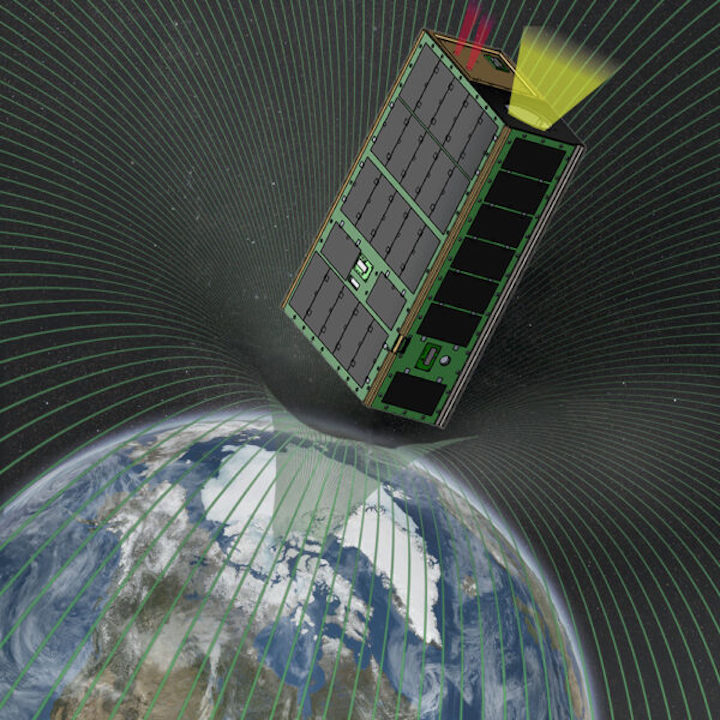
An artist's conception of the CuPID Cubesat in space. Boston University
CubeSat missions are set to address big questions, in Earth orbit and beyond. One such upcoming mission is the Cusp Plasma Imaging Detector (CUPID), built around a 6U CubeSat chassis about the size of a toaster oven. Launching next week as part of a rideshare mission along with Landsat 9, CUPID will study the Sun-Earth boundary on a wide scale.
Boston University
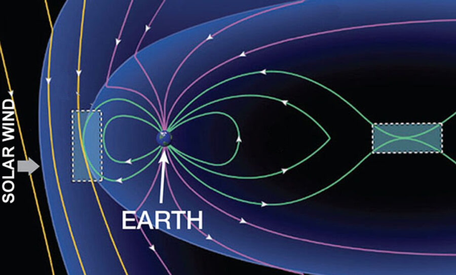
From its vantage point in low-Earth orbit 550 kilometers (340 miles) up, CUPID will study charge exchange between the charged solar wind and neutral atoms in Earth's upper atmosphere, a process that is still poorly understood.
During periods of high solar activity, the magnetic fields of the Sun and Earth can fuse in a process known as magnetic reconnection, allowing charged particles from the Sun to leak in toward Earth's atmosphere. Understanding these interactions is crucial, as the charged particles may put satellites and astronauts in harm’s way.
"CUPID will image how plasma streaming from the Sun enters Earth's space environment," says principal investigator Brian Walsh (Boston University). "This plasma carries with it energy and momentum, which drives dynamics in the Earth's space environment."
NASA
MICRO VS. MACRO VIEWS
While spacecraft such as NASA’s Magnetospheric Multiscale (MMS) mission study magnetic reconnection events on a micro scale, the much-smaller CUPID probe will provide a macro-scale view by means of its wide-field X-ray camera.
Every time charged particles interact with neutral atoms in Earth's atmosphere, exchanging electrons, X-rays are released in the process. But capturing a wide-field perspective of the process from close-up and then bringing it into focus is a challenge. That's especially true for CUPID — most focusing X-ray telescopes are built on the scale of schoolbuses, not toasters.
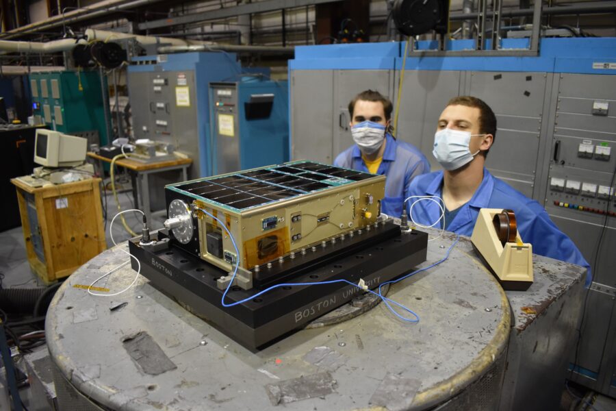
To focus X-rays within such a small spacecraft, CUPID will use a grid of tightly-packed channels. The design has been in development at NASA's Goddard and Wallops Flight facility for the past 16 years, and a proof of concept prototype flew on a suborbital rocket launch out of White Sands in 2012. A second suborbital launch in 2015 allowed researchers to miniaturize the payload, for eventual orbital launch as a CubeSat.
NASA / Chris Gunn
Building CUPID has taught researchers and engineers key lessons in putting an X-ray telescope mission in a small package. Previous X-ray space observatories such as ROSAT, Chandra and XMM-Netwon relied on large focusing elements a meter in size to produce a field of view less than a degree across.
"CUPID uses a new type of focusing element called 'lobster-eye optics,' says Walsh. "These optics allow CUPID to image with a wide field of view in the compact package of a CubeSat."
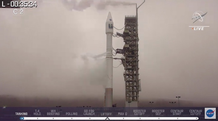
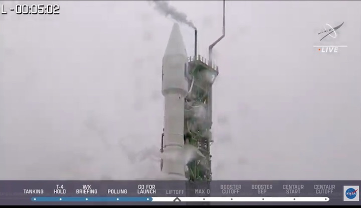
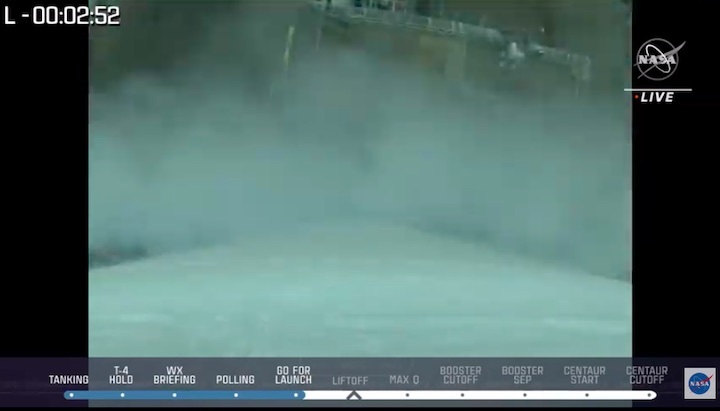
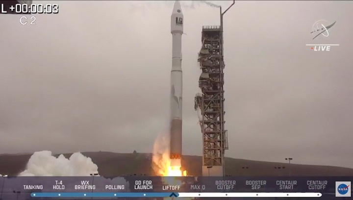
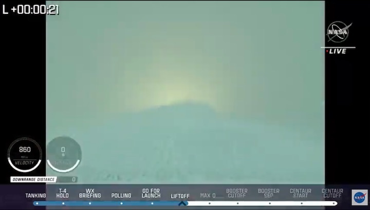
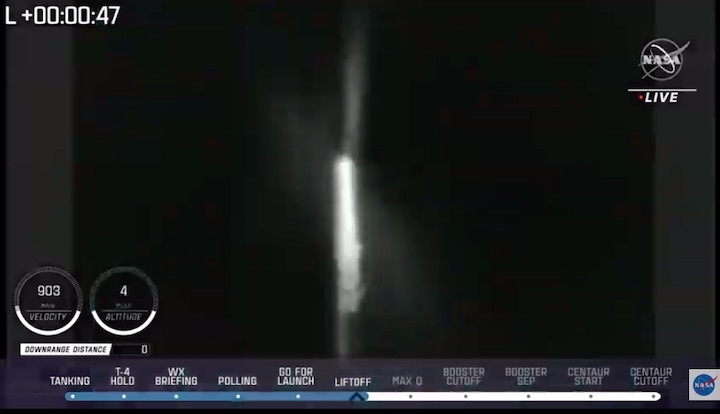
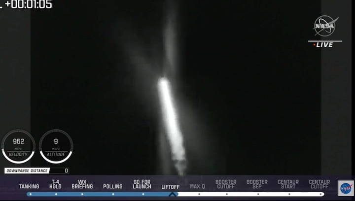
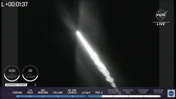
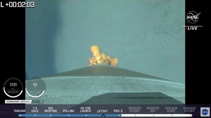
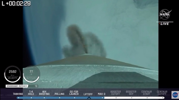
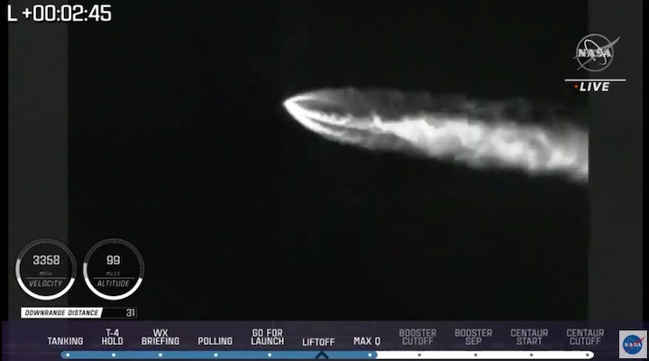
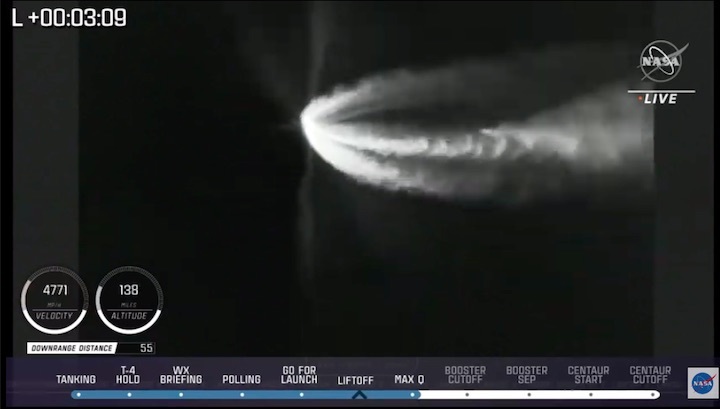
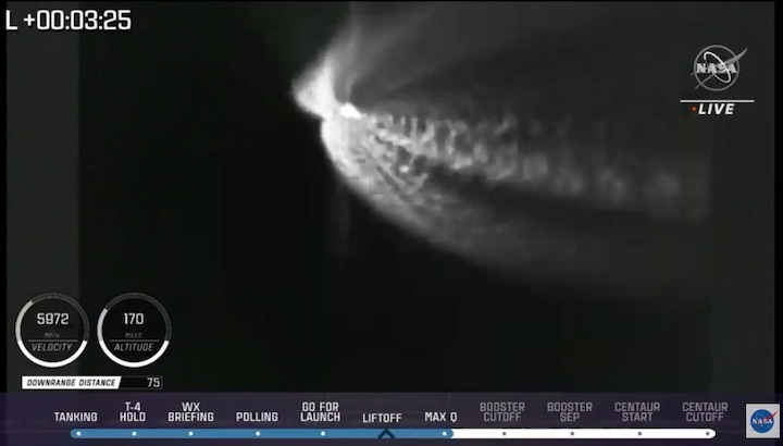
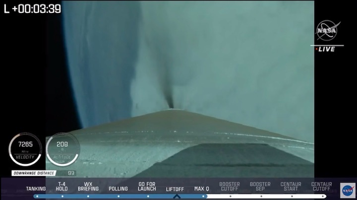
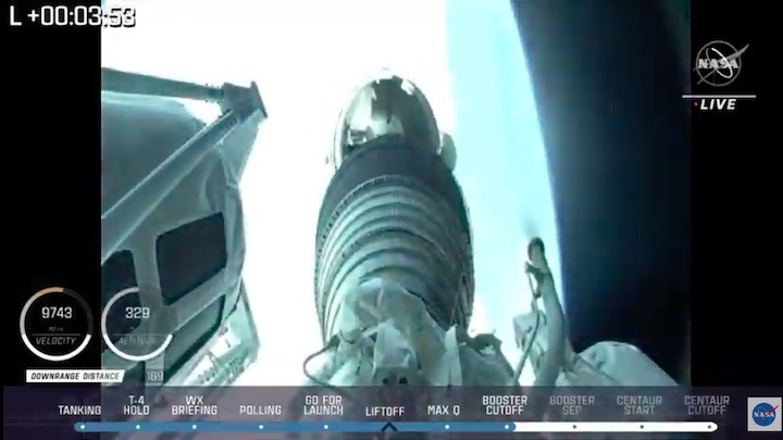
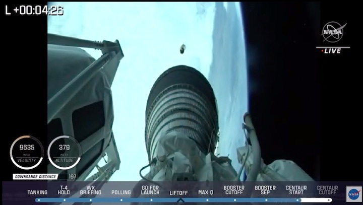
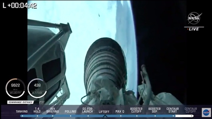
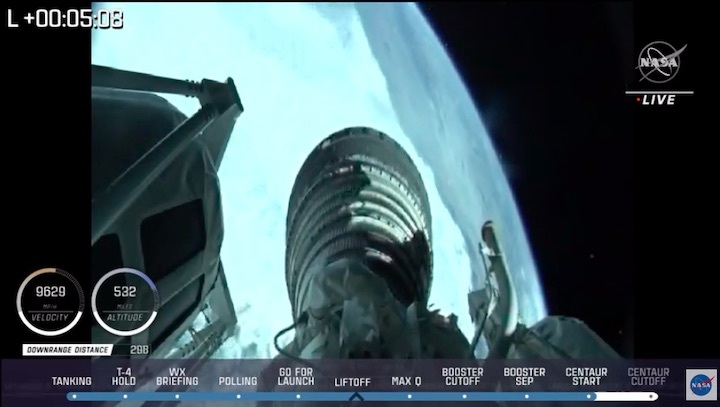
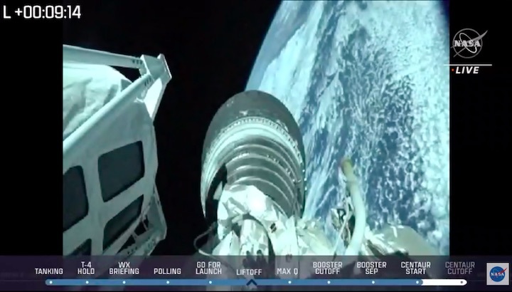
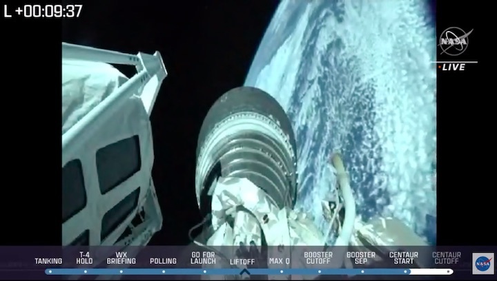
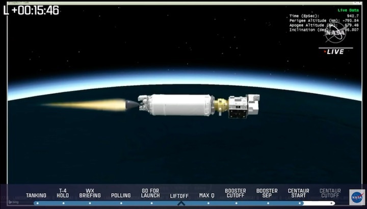
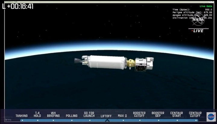
Landsat 9 is launching out of Vandenberg Space Force Base on Monday, September 27th at 18:11 UT (2:11 p.m. EDT) atop an Atlas V rocket. Also onboard the Educational Launch of Naonsatellites 34th rideshare mission is the Colorado Ultraviolet Transit Experiment (CUTE), which will characterize the atmospheres of exoplanets in the near-ultraviolet (255-330 nanometer) range, and two 6U CubeSats for the CesiumAstro company.
All of these missions are headed into a Sun-synchronous orbit. Landsat 9 is part of an Earth-observing legacy that dates back to the Landsat 1 mission launched in 1972.
It will be exciting to see CUPID take to space next week.
Quelle: Sky&Telescope
----
Update: 24.09.2021
.
Lompoc celebrates Monday rocket launch with 'Landsat 9 Launch Week' events
United Launch Alliance is scheduled to launch an Atlas V rocket from Vandenberg Space Force Base on Monday, September 27.
The rocket will carry NASA's Landsat 9 satellite into orbit.
The Landsat program, a partnership between NASA and the U.S. Geological Survey, has been ongoing for nearly 50 years, providing a record of Earth's changing landscapes.
Every Landsat satellite has been launched from Vandenberg since the program started in 1972.
Landsat 9 will replace Landsat 7, which was launched in 1999, and together with Landsat 8, will collect images of Earth's forests, farms, cities, lakes, and coastlines.
According to NASA, Landsat 9 can take more than 700 images of Earth per day.
Monday's launch is scheduled to take place at 11:11 a.m.
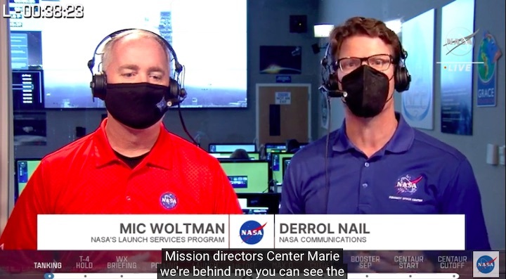
United Launch Alliance plans to offer a livestream of the launch. Live coverage will also be available starting at 10:30 a.m. on NASA Television.
Several events to celebrate "Landsat 9 Launch Week" are taking place in Lompoc leading up to Monday's launch:
- Earth As Art Exhibit in the Lompoc Library's Grossman Gallery, Thursday, Sept. 23 - Thursday, Sept. 30, 10 a.m. to 5 p.m. each day
- Family Fun Day at the Lompoc Aquatic Center, Sunday, Sept. 26, noon to 1:30 p.m.
- Landsat Week Proclamation and Wall Mural Ceremony at Ocean Avenue and I Street, Sunday, Sept. 26, 2 p.m.
- Landsat for Climate Event: Talk about Landsat and Climate at Montemar Wines, Sunday, Sept. 26, 5 p.m. to 8 p.m.
- Raising a Glass in Wine Country to Better Water Management at Montemar Wines, Sunday, Sept. 26, 5 p.m. to 8 p.m.
- Landsat 9 Launch Viewing and Public Exhibits at Lompoc Airport, Monday, Sept. 27, 9 a.m. to noon
- Ladies of Landsat: Power of the Pixel from 1972 to 2021 at Montemar Wines, Monday, Sept. 27, 2 p.m. to 3:30 p.m.
- Landsat Collage Workshop at Lompoc Library, Monday, Sept. 27, 3 p.m. to 4 p.m.
More information about each event can be found on the Explore Lompoc website.
For the next year, people can also participate in a GeoTour called "The History of Landsat in Lompoc." It includes nine different geocaches that guide participants through the city and history of the Landsat program.
The first 500 people to complete the GeoTour will receive a commemorative geocoin.
Quelle: KSBY6
----
Update: 27.09.2021
.
Vandenberg Space Force Base to celebrate 2,000th launch with Landsat 9 takeoff

VANDENBERG SPACE FORCE BASE, Calif. - Team Vandenberg will be celebrating its 2,000th launch on Monday with the scheduled takeoff of a United Launch Alliance Atlas V rocket.
The rocket is set to launch around 11:11 a.m. PDT from Space Launch Complex-3. It will be carrying the NASA Launch Program Landsat 9 observatory into a near-polar, sun-synchronous orbit.
Landsat is a decades-old partnership between NASA, the U.S. Geological Survey and United Launch Alliance.

New satellites will photograph the earth for landscape changes including those caused by climate change.
Col. Rob Long will be the launch decision authority on this historic mission from the Western Range on Vandenberg Space Force Base.
“The 2000th launch gives us the opportunity to celebrate the tens of thousands from Team Vandenberg, past and present, who share a proud heritage beginning with the first launch in 1958 through this 2000th launch,” said Long. “Space—and launch—is hard. Our record of success is a testament to longstanding mission excellence.”
Vandenberg said the unique geographic location of its base makes it a safe and ideal setting for test launching intercontinental ballistic missiles, intermediate-range ballistic missiles and for placing satellite payloads into polar orbit.
To celebrate its milestone launch, Vandenberg is inviting the public to watch the takeoff from the Hawk's Nest on Highway 1 just half a mile south from the base's main gate.
The Hawk's Nest gates will open at 9:45 a.m. on Monday.
Fox News Channel
+++

Quelle: NASA
+++


Quelle: NASA