
9.11.2018
It was five years ago this month that ESA’s GOCE gravity-mapping satellite finally gave way to gravity, but its results are still yielding buried treasure – giving a new view of the remnants of lost continents hidden deep under the ice sheet of Antarctica.
A research team from Germany’s Kiel University and the British Antarctic Survey published their latest GOCE-based findings this week in the journal Scientific Reports.
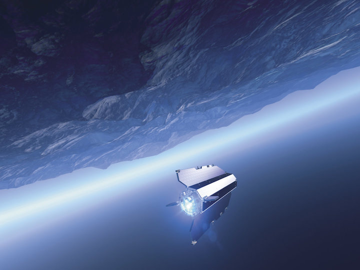
Dubbed ‘the Formula one of space’, the GOCE (Gravity field and Ocean Circulation Explorer) mission orbited Earth for more than four years, from March 2009 to November 2013. This sleek, finned satellite with no moving parts was designed around a single goal: to measure the pull of Earth’s gravity more precisely than any mission before.
GOCE flew at an altitude of just 255 km, more than 500 km nearer than a typical Earth observation satellite, to maximise its sensitivity to gravity.
In its last year in orbit, with its supply of xenon propellant holding out well, GOCE was manoeuvred down still lower, to just 225 km altitude, for even more accurate gravity measurements. The propellant keeping it resistant to air drag was finally spent in October 2013, and it reentered the atmosphere three weeks later.
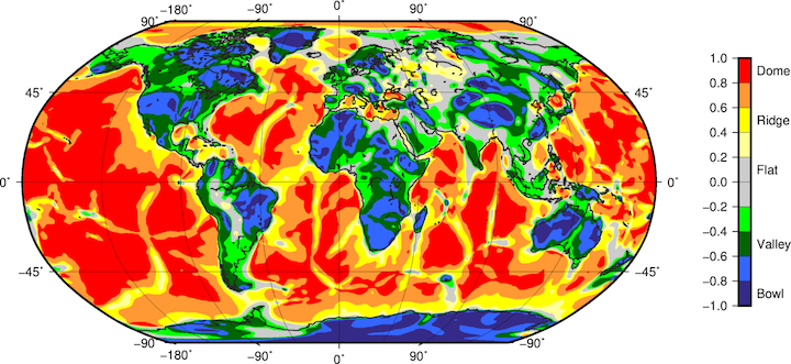
GOCE’s main output was a high-fidelity global gravity map or ‘geoid’, but the mission also charted localised gravity gradients – measurements of how rapidly the acceleration of gravity changes – across all directions of motion, down to a resolution of 80 km.
The team from Kiel University and BAS has converted this patchwork of 3D gravity measurements into curvature-based ‘shape indexes’ across the different regions of our planet, analogous to contours on a map.
The study’s lead author Prof Jörg Ebbing from Kiel University comments, “The satellite gravity data can be combined with seismological data to produce more consistent images of the crust and upper mantle in 3D, which is crucial to understand how plate tectonics and deep mantle dynamics interact.”
In combination with existing seismological data, these gravity gradients show high sensitivity to known features of Earth’s ‘lithosphere’, the solid crust and that section of the molten mantle beneath it.
These features include dense rocky zones called cratons – remnants of ancient continents found at the heart of modern continental plates – highly folded ‘orogen’ regions associated with mountain ranges and the thinner crust of ocean beds.
The new window into the deep subsurface offered by this data offers novel insights into the structure of all Earth’s continents, but especially Antarctica. With more than 98% of its surface covered by ice with an average thickness of 2 km, the southern continent largely remains a blank spot on current geological maps.
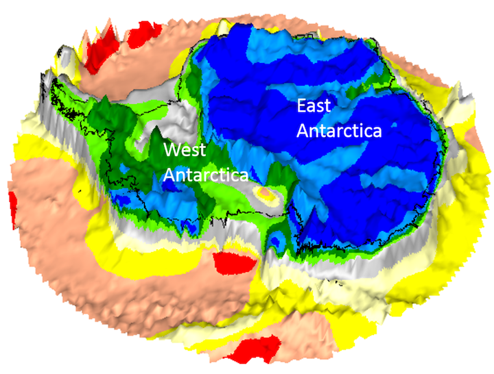
“These gravity images are revolutionising our ability to study the least understood continent on Earth, Antarctica,” says co-author Fausto Ferraccioli, Science Leader of Geology and Geophysics at BAS.
“In East Antarctica we see an exciting mosaic of geological features that reveal fundamental similarities and differences between the crust beneath Antarctica and other continents it was joined to until 160 million years ago.”
The gravity gradient findings show West Antarctica has a thinner crust and lithosphere compared to that of East Antarctica, which is made up of a mosaic of old cratons separated by younger orogens, revealing a family likeness to Australia and India.
These findings are of more than purely historic geological interest. They give clues to how Antarctica’s continental structure is influencing the behavior of ice sheets and how rapidly Antarctica regions will rebound in response to melting ice.
ESA’s GOCE mission scientist Roger Haagmans adds, “It is exciting to see that direct use of the gravity gradients, which were measured for the first time ever with GOCE, leads to a fresh independent look inside Earth – even below a thick sheet of ice.
“It also provides context of how continents were possibly connected in the past before they drifted apart owing to plate motion.”
Quelle: ESA