
22.04.2023
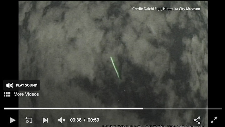
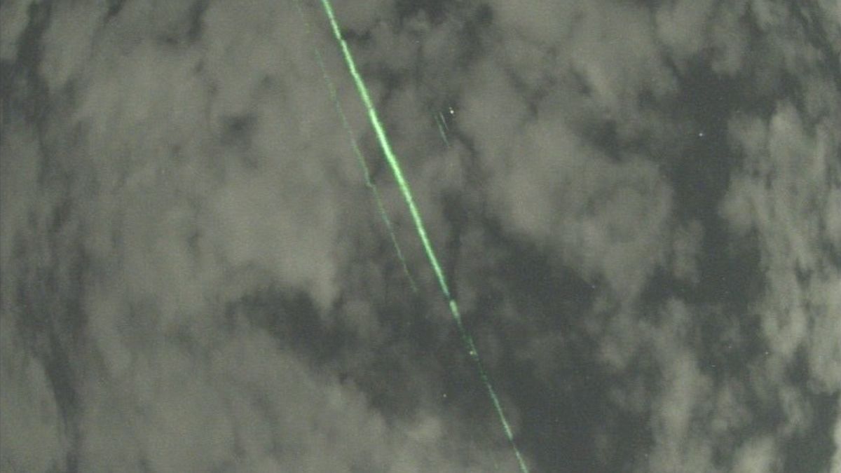
A mysterious spectacle of green laser beams in the sky was caught on video by motion-detecting cameras positioned outside Hiratsuka City Museum in Japan.
Daichi Fujii, the museum curator, set up the motion-detecting cameras to capture meteors and calculate their position, brightness and orbit. At first, the bright green lines that appeared on the camera footage from Sept. 16, 2022, were a mystery. However, further inspection revealed the beams were synchronized with a tiny green dot that was briefly visible between the clouds.
As it turns out, the lasers were being beamed down from space by one of NASA's Earth-orbiting satellites. The Ice, Cloud and Land Elevation Satellite 2, or ICESat-2, flew over the museum at the perfect time for its green lasers to be caught in action, streaming from orbit to Earth.
The museum's motion detector footage is the first time the satellite's laser beams have been caught on camera, according to a NASA statement(opens in new tab).
On Sept. 16, 2022, motion-sensing cameras set up by Hiratsuka City Museum curator Daichi Fujii to capture meteors instead caught the laser beams of NASA's ICESat-2 satellite as it passed over Japan. It's the first time the ICESat-2 team has seen footage of the lasers at work in orbit. (Image credit: Daichi Fujii, Hiratsuka City Museum/NASA)
"ICESat-2 appeared to be almost directly overhead of [the museum], with the beam hitting the low clouds at an angle," Tony Martino, ICESat-2 instrument scientist at NASA's Goddard Space Flight Center in Greenbelt, Maryland, wrote in the statement(opens in new tab) from the space agency. "To see the laser, you have to be in the exact right place, at the right time, and you have to have the right conditions."
ICESat-2, which launched in September 2018, uses lasers and a very precise detection instrument to measure the elevation of ice sheets, sea ice thickness and land topography on Earth. The laser instrument is technically a lidar sensor, which stands for Light Detection and Ranging. Lidar sensors are typically used to generate precise 3D measurements, and are also used by autonomous vehicles to sense their surroundings. The lidar system aboard ICESat-2 fires 10,000 times a second, sending six beams of light to Earth from orbit.
"It precisely times how long it takes individual photons to bounce off the surface and return to the satellite," NASA wrote in the statement. "Computer programs use these measurements to calculate ice losses from Greenland and Antarctica, observe how much of the polar oceans are frozen, determine the heights of freshwater reservoirs, map shallow coastal regions, and more."
Generally, the satellite's laser beams are difficult to spot from Earth. Located hundreds of miles up in space, the lasers have roughly the strength of a camera flash more than 100 yards away. Plus, the laser's light has to reflect off something to be seen. However, on Sept. 16, 2022, there were just enough cloudsto scatter — not obscure — the laser light, making it visible to the museum's cameras.
"With the precise location of the satellite in space, the location of where the beam hit, the coordinates of where Fujii's cameras were set up, and the addition of cloudy conditions, Martino was able to confirm, definitively, that the streaks of light came from ICESat-2's laser," NASA officials added in the statement.
Quelle: SC