
.
Just four days after being lofted into orbit, Europe’s Sentinel-2A satellite delivered its first images of Earth, offering a glimpse of the ‘colour vision’ that it will provide for the Copernicus environmental monitoring programme.
With a swath width of 290 km, the satellite’s first acquisition began in Sweden and made a strip-like observation through central Europe and the Mediterranean, ending in Algeria.
The data were relayed in real time to Italy’s Matera ground station, where teams eagerly awaited their arrival for processing.
While northern and central Europe was mostly cloudy, Italy’s typical sunny weather allowed the teams to get their first glimpse of the multispectral instrument’s capabilities over the northwestern part of the country and the French Riviera – and they were excited by what they saw. With a ground resolution of 10 m per pixel, the images show individual buildings in Milan, agricultural plots along the Po River, and ports along the southern French coast.
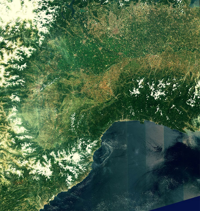
Northwest Italy and southern France
Acquired on 27 June 2015 at 10:25 UTC (12:25 CEST), just four days after launch, this first image from Sentinel-2A covers the Po Valley, framed by the Alps in the north and the coastal mountains of France and Italy in the south.
Note: Due to the large size of these image files, full 10 m resolution are not available in these web downloads.
Credits: Copernicus data (2015)/ESA
.
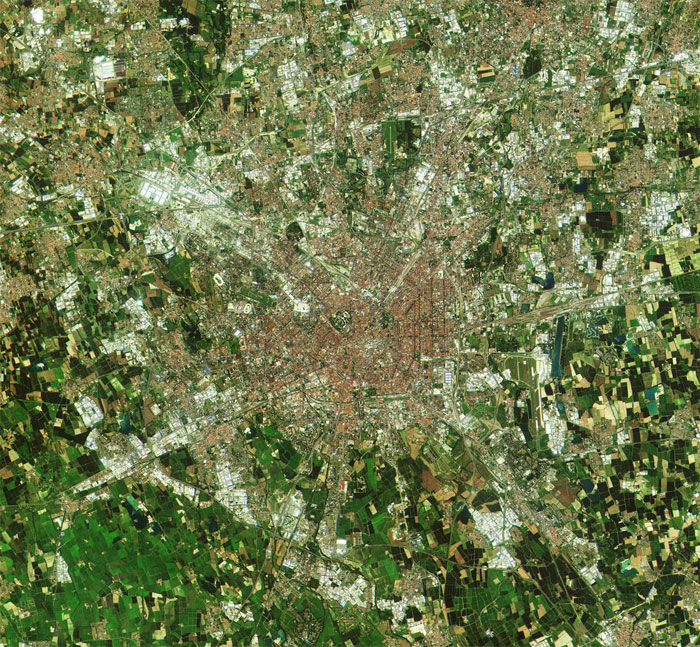
Milan, Italy
This close-up of Milan is a subset from the first image from the Sentinel-2A satellite, acquired on 27 June 2015 at 10:25 UTC (12:25 CEST), just four days after launch.
Credits: Copernicus data (2015)/ESA
.
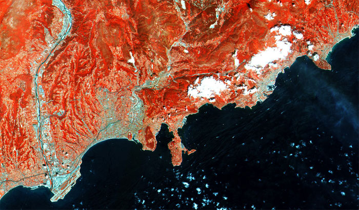
French Riviera
Acquired on 27 June 2015 at 10:25 UTC (12:25 CEST), just four days after launch, this close-up of France’s southern coast from Nice airport (lower left) to Menton (upper right) is a subset from the first image from the Sentinel-2A satellite. This false colour image was processed including the instrument’s high-resolution infrared spectral channel.
Credits: Copernicus data (2015)/ESA
.

Po Valley, Italy
A close-up of an area in the Po Valley – showing Pavia (centre) and the confluence of the Ticino and Po rivers – is a subset from the first image from the Sentinel-2A satellite acquired on 27 June 2015 at 10:25 UTC (12:25 CEST), just four days after launch. Processed using the high-resolution infrared spectral channel, the satellite’s instrument will provide key information on crop type and health, assisting in food security activities.
Credits: Copernicus data (2015)/ESA
Quelle: ESA
4318 Views