
.
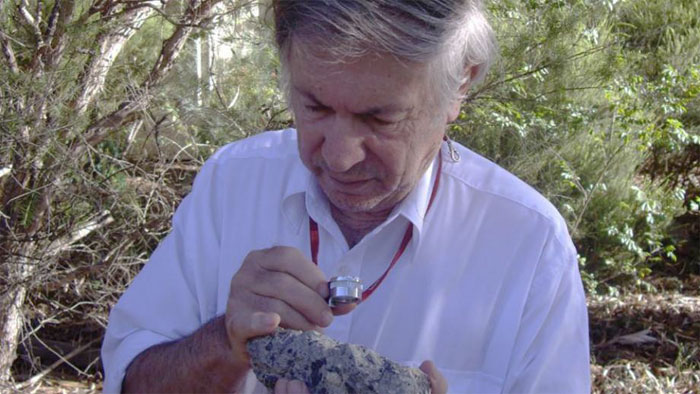
Dr Andrew Glikson with a sample of suevite - a rock with partially melted material formed during an impact. Image: D. Seymour
.
A 400 kilometre-wide impact zone from a huge meteorite that broke in two moments before it slammed into the Earth has been found in Central Australia.
The crater from the impact millions of years ago has long disappeared. But a team of geophysicists has found the twin scars of the impacts – the largest impact zone ever found on Earth – hidden deep in the earth’s crust.
Lead researcher Dr Andrew Glikson from the ANU School of Archaeology and Anthropology said the impact zone was discovered during drilling as part of geothermal research, in an area near the borders of South Australia, Queensland and the Northern Territory.
“The two asteroids must each have been over 10 kilometres across – it would have been curtains for many life species on the planet at the time,” said Dr Glikson.
The revelation of such ancient violent impacts may lead to new theories about the Earth’s history.
“Large impacts like these may have had a far more significant role in the Earth’s evolution than previously thought,” Dr Glikson said.
The exact date of the impacts remains unclear. The surrounding rocks are 300 to 600 million years old, but evidence of the type left by other meteorite strikes is lacking.
For example, a large meteorite strike 66 million years ago sent up a plume of ash which is found as a layer of sediment in rocks around the world. The plume is thought to have led to the extinction of a large proportion of the life on the planet, including many dinosaur species.
However, a similar layer has not been found in sediments around 300 million years old, Dr Glikson said.
“It’s a mystery – we can’t find an extinction event that matches these collisions. I have a suspicion the impact could be older than 300 million years,” he said.
A geothermal research project chanced on clues to the impacts while drilling more than two kilometres into the earth’s crust.
The drill core contained traces of rocks that had been turned to glass by the extreme temperature and pressure caused by a major impact.
Magnetic modelling of the deep crust in the area traced out bulges hidden deep in the Earth, rich in iron and magnesium, corresponding to the composition of the Earth mantle.
“There are two huge deep domes in the crust, formed by the Earth’s crust rebounding after the huge impacts, and bringing up rock from the mantle below,” Dr Glikson said.
The two impact zones total more than 400 kilometres across, in the Warburton Basin in Central Australia. They extend through the Earth’s crust, which is about 30 kilometres thick in this area.
Quelle:The Australian National University, Canberra
.
Geophysical anomalies and quartz deformation of the Warburton West structure, central Australia
Abstract
This paper reports geophysical anomalies and intra-crystalline quartz lamellae in drill cores from the Warburton West Basin overlapping the border of South Australia and the Northern Territory. The pre-Upper Carboniferous ~ 450 × 300 km-large Warburton Basin, north-eastern South Australia, is marked by distinct eastern and western magnetic, gravity and low-velocity seismic tomography anomalies. Quartz grains from arenite core samples contain intra-crystalline lamellae in carbonate–quartz veins and in clastic grains, similar to those reported earlier from arenites, volcanic rocks and granites from the Warburton East Basin. Universal Stage measurements of quartz lamellae in both sub-basins define Miller–Bravais indices of {10–12} and {10–13}. In-situ quartz lamellae occur only in pre-Late Carboniferous rocks whereas lamellae-bearing clastic quartz grains occur in both pre-Late Carboniferous and post-Late Carboniferous rocks — the latter likely redeposited from the pre-Late Carboniferous basement. Quartz lamellae in clastic quartz grains are mostly curved and bent either due to tectonic deformation or to re-deformation of impact-generated planar features during crustal rebound or/and post-impact tectonic deformation. Seismic tomography low-velocity anomalies in both Warburton West Basin and Warburton East Basin suggest fracturing of the crust to depths of more than 20 km. Geophysical modelling of the Cooper Basin, which overlies the eastern Warburton East Basin, suggests existence of a body of high-density (~ 2.9–3.0 gr/cm3) and high magnetic susceptibility (SI ~ 0.012–0.037) at a depth of ~ 6–10 km at the centre of the anomalies. In the Warburton West Basin a large magnetic body of SI = 0.030 is modelled below ~ 10 km, with a large positive gravity anomaly offset to the north of the magnetic anomaly. In both the Warburton East and Warburton West the deep crustal fracturing suggested by the low velocity seismic tomography complicates interpretations of the gravity data. Universal Stage measurements of quartz lamellae suggest presence of both planar deformation features of shock metamorphic derivation and deformed planar lamella. The latter may be attributed either to re-deformation of impact-generated lamella, impact rebound deformation or/and post impact tectonic deformation. The magnetic anomalies in the Warburton East and West sub-basins are interpreted in terms of (1) presence of deep seated central mafic bodies; (2) deep crustal fracturing and (3) removal of Devonian and Carboniferous strata associated with rebound of a central uplift consequent on large asteroid impact. Further tests of the Warburton structures require deep crustal seismic transects.
Quelle: Tectonophysics
4318 Views