

19.12.2017
World View Enterprises’ first near-space pictures demonstrate how the Arizona company’s balloon-based imaging platform can rival satellite views.
The photos were released today in conjunction with the Next-Generation Suborbital Researchers Conference in Colorado.
Tucson-based World View is working on what it calls its Stratollite system, which puts scientific instruments on a platform that’s lofted into the stratosphere on the end of a helium-filled balloon. Images and other types of data can be downlinked from on high in real time, or stored for recovery when the platform descends.
“Coupled with Stratollite’s game-changing ability to persist over areas of interest for days, weeks, and months on end, the ability to capture real-time images like these will unlock unprecedented applications and markets for the Stratollite,” Jane Poynter, World View’s co-founder and CEO, said in a news release about the newly released images.
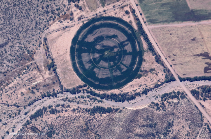
Another potential application is crop monitoring. (World View Enterprises Photo)
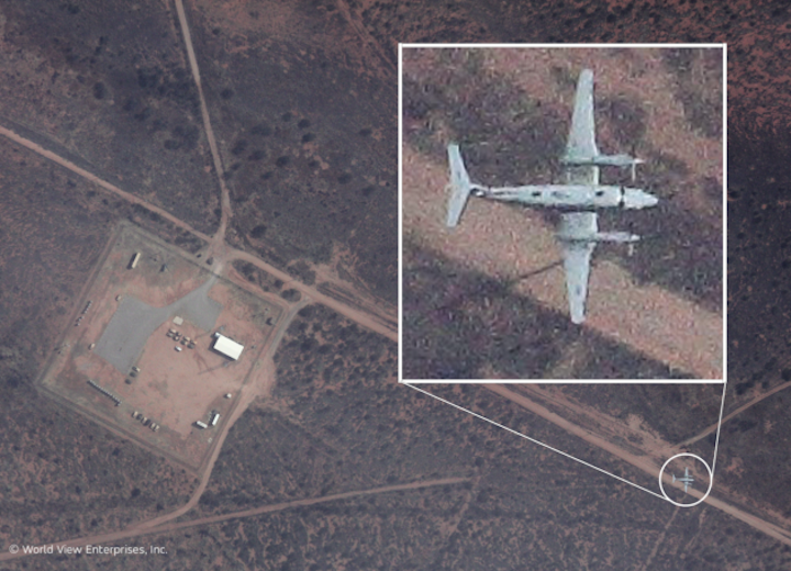
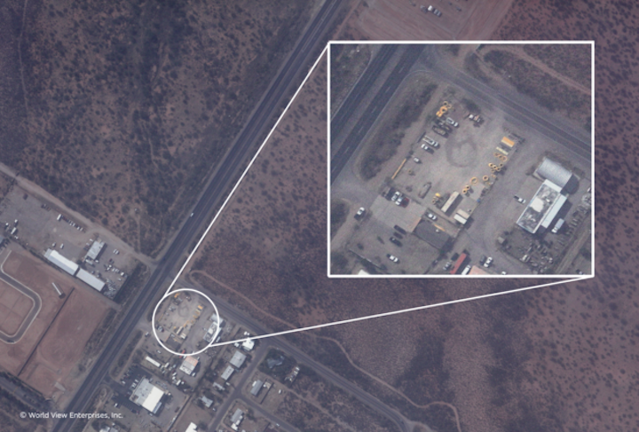
The pictures were taken from altitudes ranging between 65,000 and 75,000 feet, using an off-the-shelf imaging sensor. They show a variety of scenes with a maximum resolution of roughly 50 centimeters (20 inches) per pixel. World View says it will soon improve the resolution to reach 10 to 15 centimeters (4 to 6 inches) per pixel.
In comparison, DigitalGlobe’s WorldView-3 satellite (which isn’t associated with World View, despite its name) can produce black-and-white imagery with a top resolution of 31 centimeters (12 inches) per pixel.
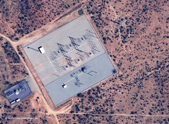
As Poynter pointed out, one of the Stratollite system’s advantages is its ability to hold a stable position over a target area by taking advantage of different wind patterns over a range of altitudes. That would allow users to monitor sensitive sites such as power stations or military installations continuously. Stratollites could also keep track of agricultural sites to check in on crop conditions. The photos released today address those types of potential applications.
World View hasn’t publicized precise prices for its services, but Poynter has said it could be orders of magnitude less than the cost of putting up an imaging satellite, or the cost sending up a drone when calculated on a per-hour basis. The company said it’s already demonstrating remote-sensing capabilities in several applications for commercial and government customers.
Eventually, World View aims to send up tourists to the stratosphere for astronaut’s-eye views of the Earth below, with the ticket price set at $75,000.For now, however, the Stratollite applications have taken a higher priority.
Quelle: GeekWire